For the love of maps
Why I'm joining the maps as media course as a satellite blogger
I love maps. Three glimpses of geo-spatial data in my life:
Aged 10(?), staying up late on holiday in the south of France devouring Lord of the Rings, flipping back and forth between the text and the map of Middle Earth on the front pages. I’d go on to basically only read books in my teenage years that had maps drawn in the front of them.
Aged 32, it’s 4am and I’m yelling at the Uber driver to get us to NYU hospital. Erin is in labour in the back seat. Turns out NYU hospital is not the correct name of the hospital and the Uber driver can’t start driving until we discover that the name of the hospital on Google Maps is Tisch hospital
Aged 34, I’m sat at a bar on my own with my heart pounding. Every 10 minutes or so I get a text message sent via Twilio as Erin works her way through a digital-driven treasure hunt using GPS data on her phone to uncover clues to find me so I could get down on one knee and propose. Yes, I built a Glitch app to build a treasure hunt to propose to Erin.
I love maps.
So - when I discovered recently that Shannon Mattern’s Maps as Media course at the New School has all of the materials posted online and that the course runs Aug - Dec and I could follow along I thought I should do this! A follow-along blogger. A satellite student perhaps.
I’m going to be following along - doing the readings and posting some thoughts to my blog here.
I’ll be collecting all of the posts under the “maps as media” tag here:
https://tomcritchlow.com/maps-as-media/
Some themes I’m interested in exploring during the course:
Playable Cities
As alluded above - I built a little GPS-driven app to propose to Erin. This kind of digital/physical crossover has always appealed to me and I’m excitied to explore a more generalized version of this “walkable story” concept.
Further reading: some of these things are not like the others - this is a deeply informative piece for me talking a lot about the “hello lam post” project which is a super simple but fun exploration of this physical/digital/spatial space.
Community Maps & Memory
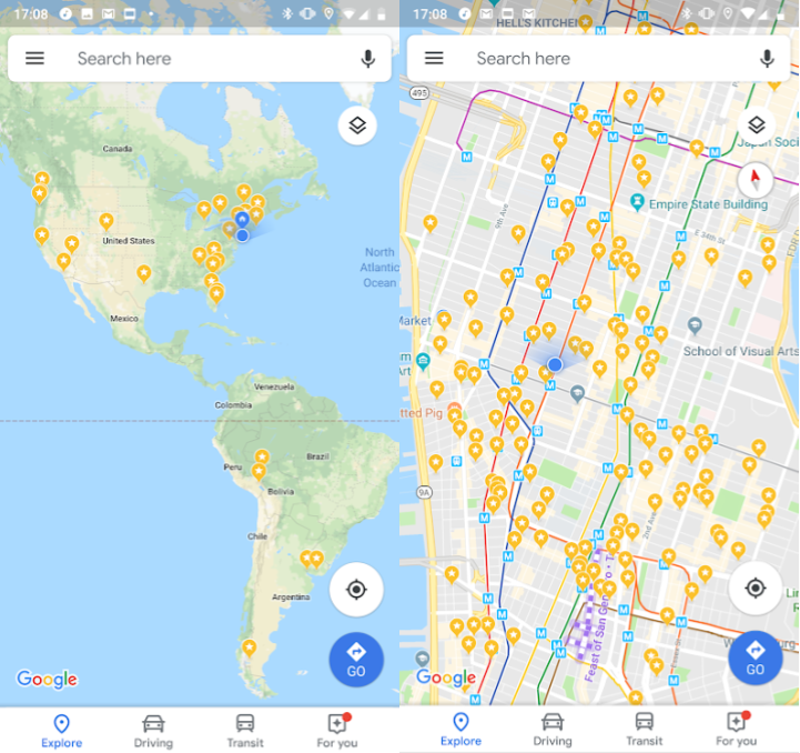
For the longest time I’ve used the “star” function inside of Google maps to create a personalized map. Everywhere I’ve been all over the world is logged in some form on Google maps. This is what Manhattan and the globe looks like:
I’m interested in maps as collaborative, community memory places.
Further reading: in the map room - which is a fascinating community / art project by Jer Thorp around projecting city maps onto pieces of paper and having different community groups draw, doodle, annotate and highlight the maps. The things that are unearthed this way are super interesting.
Pop-ups and governance
Over the past 4/5 years Erin and I have hosted a number of pop-up art shows. Some in formal gallery spaces but more often they’ve been in abandoned retail / commercial spaces (e.g. this one) - re-purposed for a period of time to host an art show.
The ability to do this basically all comes down to Erin’s hustle and wrangling. We grab some insurance, tell everyone to be careful and then hope that nothing goes wrong. But there’s so much abdondoned real estate - and so many potential creative uses for them. I’m interested in how urban spaces can be re-used, borrowed and more.
I’m reading dark matter and trojan horses by Dan Hill right now where he talks about Helsinki Street Eats as a small project that allows for experimentation in governance and law.
Further reading: Restaurant Day, edible urbanism and civic opportunism & helsinki street eats [PDF]
Visualizations and data
Data viz as it’s come to be called does appeal to me and I’m interested in it but I’m more interested in the meaning and opportunity behind mapping data. There’s more geo-located data being produced than ever before and we’re only scratching the surface on what’s possible, knowable and more.
I played around with this a while back - back when Instagram’s API was more open I had a copy of 30k photos posted over a few weeks all geo-located less than 400 yards from my home. This glimpse not into the personal feed but the “master firehose” of data is one we don’t typically get to look at.
So the technical nuts and bolts of geolocation, maps, technology and feeds is interesting to me.
Further reading: Mills Field – a weblog from SFO Museum - a blog by Aaron Cope, one of the most interesting people I have ever met. His ability to cut across the real nuts and bolts of the technology while keeping an eye on wider cultural and societal implications is incredible. It’s a little dense at times (because he really gets into it!) but so worth checking out. This piece for example all about maps and map tiles at SFO museum.
–
So here we are - I’m going to do my best to follow along with the course as a satellite blogger. I’ve provisionally blocked off “Maps Mondays” for myself to read, explore and post. I’m a few weeks behind the course but hopefully I can catch up.
If you want to join - come along for the ride!
June 8, 2026
August 22, 2025
June 27, 2025
This post was written by Tom Critchlow - blogger and independent consultant. Subscribe to join my occassional newsletter: